Pages

Showing posts with label Lava Flows. Show all posts

Saturday, July 6, 2013

Two Views of Olympus Mons' Southeast Flank


A portion of the southeastern flank of Olympus Mons as imaged by the High Resolution Stereo Camera on ESA’s Mars Express on 21 January 2013 (orbit 11524), with a ground resolution of approximately 17 m per pixel. The image center is located at approximately 14°N / 229°E. North is to the right.

The image highlights the stark contrast between the hundreds of narrow, individual lava flows on the flanks of the volcano, and the smooth lava plains that surround it.


Color-coded topographical map of the southeastern flank of the Olympus Mons volcano on Mars. The transitions from the sloping flanks of the volcano (white, red and yellow colors) to the steep cliff faces (green to light blue) and the smooth plains at its base (dark blue) can clearly be seen.

The image was taken by the High Resolution Stereo Camera on ESA’s Mars Express on 21 January 2013 (orbit 11524), with a ground resolution of approximately 17 m per pixel. The image center is located at approximately 14°N / 229°E.

Image credits: (Top) ESA/DLR/FU Berlin (G. Neukum); (Bottom) ESA/DLR/FU Berlin (G. Neukum).

Tuesday, February 26, 2013

Mercury Global Map


A global color map of Mercury's surface has been created by mosaicking thousands of sets of images obtained by the MESSENGER Wide Angle Camera (WAC). The colors shown here are related to variations in the spectral reflectance across the planet. This view captures both compositional differences and differences in how long materials have been exposed at Mercury's surface. Young crater rays, arrayed radially around fresh impact craters, appear light blue or white. Medium- and dark-blue areas are a geologic unit of Mercury's crust known as the "low-reflectance material," thought to be rich in a dark, opaque mineral. Tan areas are plains formed by eruption of highly fluid lavas. The large circular area near the top center is the Caloris impact basin, whose interior is filled with smooth, somewhat younger volcanic plains. Small orangish spots are materials deposited by explosive volcanic eruptions.

The color base map shown here consists of MDIS images taken through eight different color filters. It is part of a global color map that covers more than 99% of Mercury's surface with an average resolution of about 1 kilometer per pixel.

Instrument: Wide Angle Camera (WAC) of the Mercury Dual Imaging System (MDIS). This is an enhanced-color presentation created from a statistical combination of images taken through eight of the WAC filters.

Video credit: NASA/Johns Hopkins University Applied Physics Laboratory/Carnegie Institution of Washington; text credit: NASA/Johns Hopkins University Applied Physics Laboratory/Carnegie Institution of Washington

Note: Available on the original NASA webpage are two different size maps available for download: a smaller 6.5 MB video and a larger 23 MB video.

Monday, January 9, 2012

Floral-Shaped Volcano on Cerberus Fossae


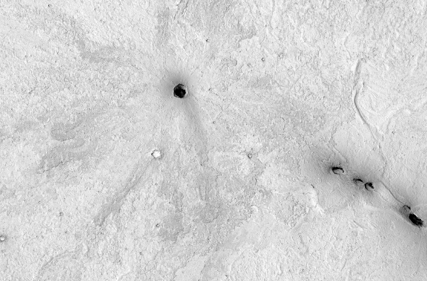
This is a small volcano superposed on the flanks of a larger one of the Cerberus Tholi.

This smaller feature has a single vent, aligned along a Cerberus Fossae trough, and it has flows radiating away from this vent in all directions, somewhat looking like a flower.

These flows appear somewhat darker than their surroundings, though this might be owing to roughness as much as to relative youth. Note that even at Context Camera (CTX) scale, we can see that there are some small impact craters superimposed on this feature, indicating that it is not entirely young.

This is a stereo pair with ESP_023811_1880.

Photo credit: NASA/JPL/University of Arizona

Note: Cerberus Tholi is a group of seven volcanic hills located in Elysium Planitia. Cerberus Tholi is located south of the eastern end of Cerberus Fossae, and roughly encircle Tombaugh Crater.

Saturday, December 25, 2010

Rimae Posidonius


Spanning over 130 km in length, Rimae Posidonius is a sinuous rille winding across the floor of Posidonius Crater. LROC WAC mosaic at 100 m/pixel, arrow points to the rille and location of an LROC NAC close-up.

Sinuous rilles are remarkable features resulting from turbulent flow of low viscosity (very fluid), high temperature lavas that erodes the pre-existing surface. In turbulent fluid flows, eddies and vortices form that can be highly erosive and result in the twists and turns seen in many rilles. This rille, located on the western edge of Posidonius Crater (~100 km diameter, floor-fractured and partially mare-filled), tightly winds against the northern crater wall and then veers away in a southerly course.


Close-up view of boulders, derived from the mare lavas that flooded the crater, outcropping from the eastern rille wall. The rille is on the left of the exposed rocks, image width is 500 m.

Why are scientists captivated by sinuous rilles? Part of the reason is purely aesthetic - each sinuous rille is different. Some sinuous rilles are less curvy, some - like Rimae Posidonius - look like squiggles, while yet other rilles are so windy that they have horseshoe-shaped curves. Scientifically, however, sinuous rilles are exciting because it's possible to see layers of mare lavas that were cut through during the rille formation - as long as the regolith slumping down the walls isn't thick enough to obscure them! Besides exposing layers in the lava flows, rilles also give you an almost dynamic look at where lava flowed, suggesting very high effusion rates over long periods of time (often much higher than typical of those on Earth). Some rilles are believed to contain pyroclastics, which can tell scientists something about the volcanic history of the rille. Sinuous rilles in the Rimae Prinz region of the Moon may even host a lava tube network; lava tubes may be instrumental in future human exploration activities.

Photo credit: NASA/GSFC/Arizona State University