Pages

Showing posts with label Landslides. Show all posts

Wednesday, November 19, 2014

Geological Map of Vesta


This high-resolution geological map of Vesta is derived from Dawn spacecraft data. Brown colors represent the oldest, most heavily cratered surface. Purple colors in the north and light blue represent terrains modified by the Veneneia and Rheasilvia impacts, respectively. Light purples and dark blue colors below the equator represent the interior of the Rheasilvia and Veneneia basins. Greens and yellows represent relatively young landslides or other downhill movement and crater impact materials, respectively. This map unifies 15 individual quadrangle maps published this week in a special issue of Icarus. Map is a Mollweide projection, centered on 180 degrees longitude using the Dawn Claudia coordinate system.

Map credit: NASA/JPL-Caltech/ASU

Note: For more information, see PIA18789: Geological Time Scale of Vesta and Geologic Maps of Vesta from NASA's Dawn Mission Published.

Saturday, May 24, 2014

Fresh Impact Crater Northeast of Gordii Dorsum on Mars


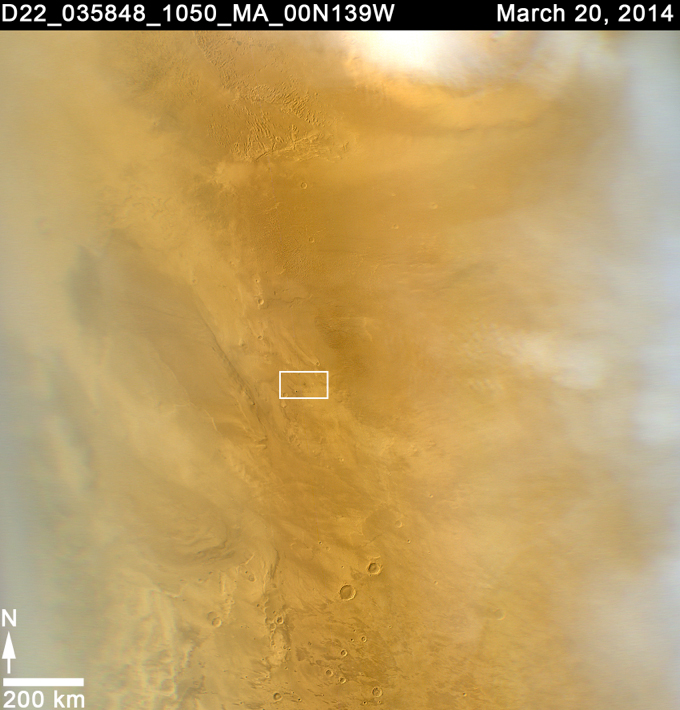
On 20 March 2014, a dark spot on the surface of Mars, about 5 miles (8 kilometers) in diameter was seen for the first time in low-resolution (approximately 1 kilometer) imaging from the Mars Color Imager (MARCI) camera on Mars Reconnaissance Orbiter (MRO). Because MARCI sees essentially the whole planet every day, the sudden appearance of a dark spot was of note.

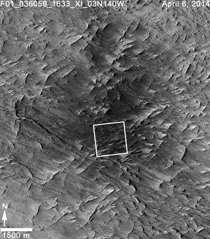
To follow up, the Context Camera (CTX) obtained a high resolution picture of the area in question in early April. Before and after imaging revealed two new large impact craters within the blast zone. At 6 meters per pixel, CTX can detect the dark blast locations but usually cannot resolve the crater that formed the blast, because most fresh impact craters are only a few meters across.

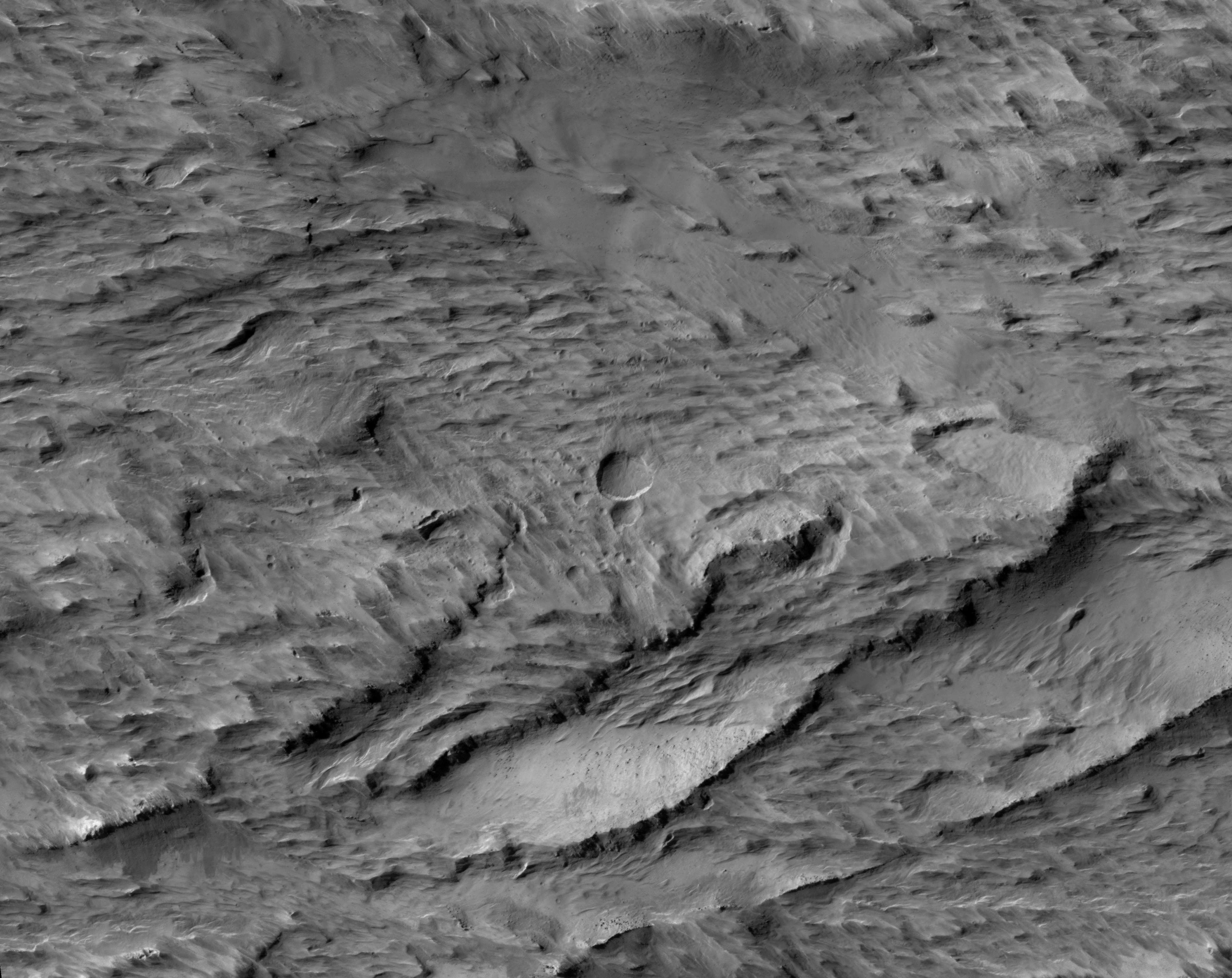
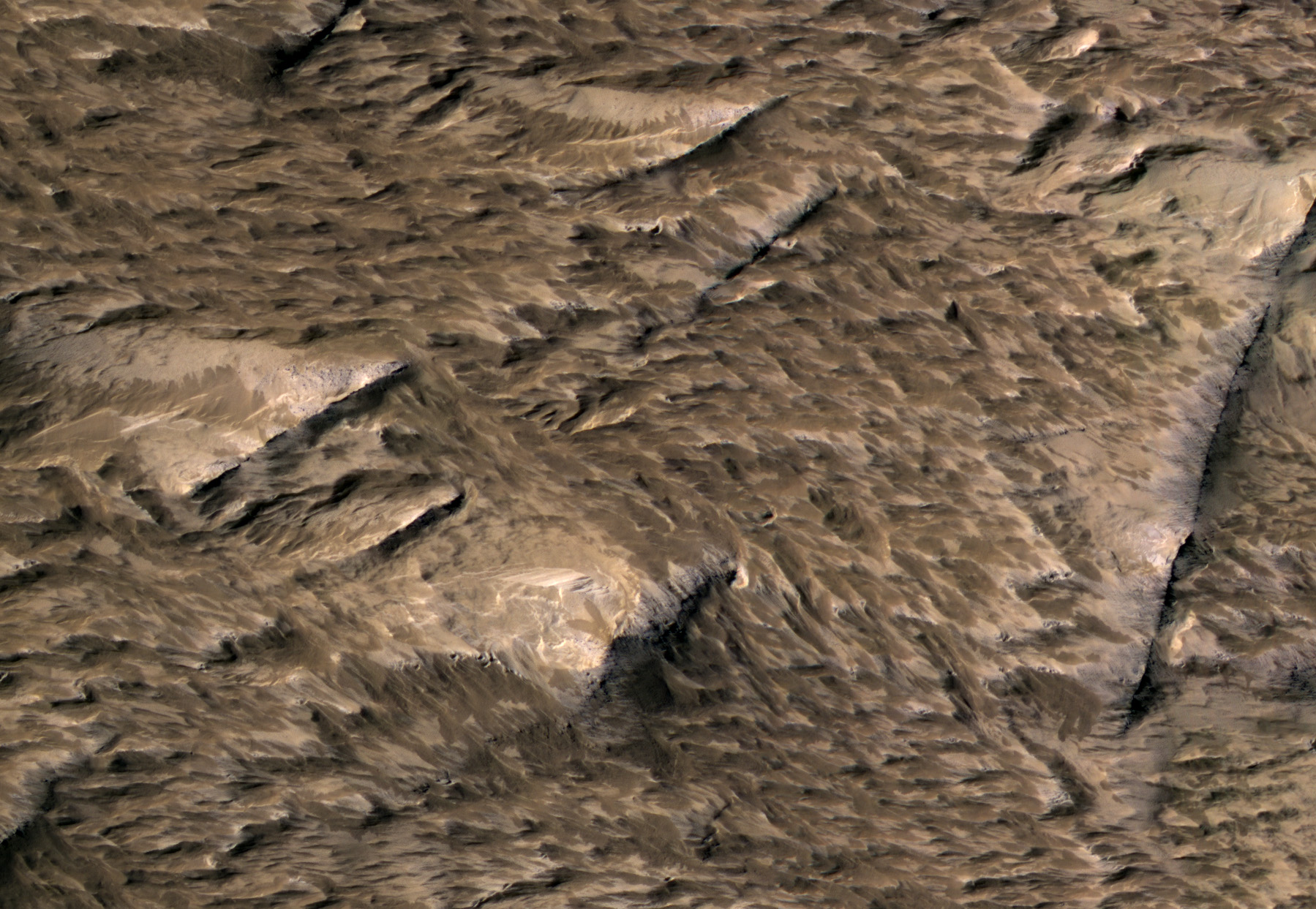
This is where the high resolution of HiRISE comes in: our camera was able to show the fine surface details within the blast zone. The largest of the new craters, appears slightly asymmetric in shape, and measures 159 x 143 feet (48.5 x 43.5 meters) in diameter, making it the largest new crater detected on Mars by MRO to date. Both HiRISE and CTX images also show numerous, new, small landslides within the blast zone.

All of these coordinated observations also demonstrate how different teams on the same spacecraft can work together to examine interesting features in greater detail.

Note: a newer image of this area, is also available and has an anaglyph.

Image credit: NASA/JPL/University of Arizona

Note: This impact crater is located just to the northeast of Gordii Dorsum. For more information, see PIA18380: Impact Scar Detected in Mars Weathercam Image, PIA18381: Best-Ever Pinning Down When a Space Rock Hit Mars, PIA18382: Fresh Mars Crater Confirmed Within Impact Scar, PIA18383: Before-and-After Views Confirm Fresh Craters, PIA18384: Large, Fresh Crater Surrounded by Smaller Craters, PIA18385: Landslides Near Fresh Crater on Mars, and NASA Mars Weathercam Helps Find Big New Crater.

Sunday, May 13, 2012

Vesta's Snowman Craters in Color


Three impact craters of different sizes, arranged in the shape of a snowman, make up one of the most striking features on Vesta, as seen in this view from NASA's Dawn mission. In this view the three "snowballs" are upside down, so that the shadows make the features easily recognizable. North is to the lower right in the image, which has a resolution of 230 feet (70 meters) per pixel.

The image is composed of many individual photographs taken between October and December 2011 by Dawn's framing camera. They were obtained during the high-altitude mapping orbit, at about 420 miles (680 kilometers) above Vesta's surface.

The largest of the three craters, Marcia, has a diameter of about 40 miles (60 kilometers). The central crater, which is about 30 miles (50 kilometers) in diameter, is named Calpurnia, and the lower crater, named Minucia, has a diameter of about 14 miles (22 kilometers). Marcia and Calpurnia are possibly the result of an impact by doublet asteroids, whereas Minucia was formed by a later impact.

To derive the color information, scientists combined images acquired by the framing camera in two near-infrared channels (0.917 microns and 0.749 microns) and an ultraviolet channel (0.438 microns). The true colors of the surface of Vesta differ somewhat from what is displayed here, but this mode of reproduction allows subtle changes in material properties across the craters and material ejected from impacts to be detected. In both Marcia and Calpurnia, landslides can be seen; also, dark material has been exposed below the rim of Marcia.

Photo credit: NASA/JPL-Caltech/UCLA/MPS/DLR/IDA